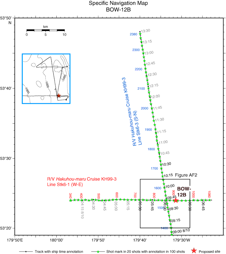
Figure AF1. Specific navigation map of Hakuhou-maru Cruise KH99-3 around primary Site BOW-12B with ship time and shotpoint annotation. Crossing of survey lines is at 06:02:15, Shotpoint 863, on Line Stk6-1 (W–E) and 09:42:05, Shotpoint 1537, on Line Stk6-3 (S–N). Site BOW-12B is located at 06:13:20, Shotpoint 910, on Line Stk6-1 (W–E). Squares = navigation map area for close-up seismic profiles in Figure AF2. Time annotation in black letters = range of subbottom profile survey in Figure AF8.
Close | Next | Top of page