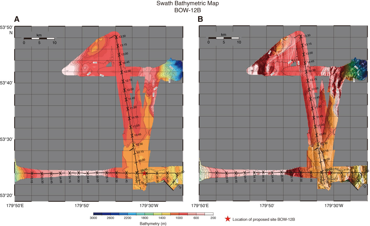
Figure AF3. Swath bathymetric map with track chart of Hakuhou-maru Cruise KH99-3 around Site BOW-12B. A. Plain image. B. Shaded relief image. Crossing of survey lines is at 06:02:15, Shotpoint 863, on Line Stk6-1 (W–E) and 09:42:05, Shotpoint 1537 on Line Stk6-3 (S–N). Site BOW-12B is located at 06:13:20, Shotpoint 910, on Line Stk6-1 (W–E).
Previous | Close | Next | Top of page