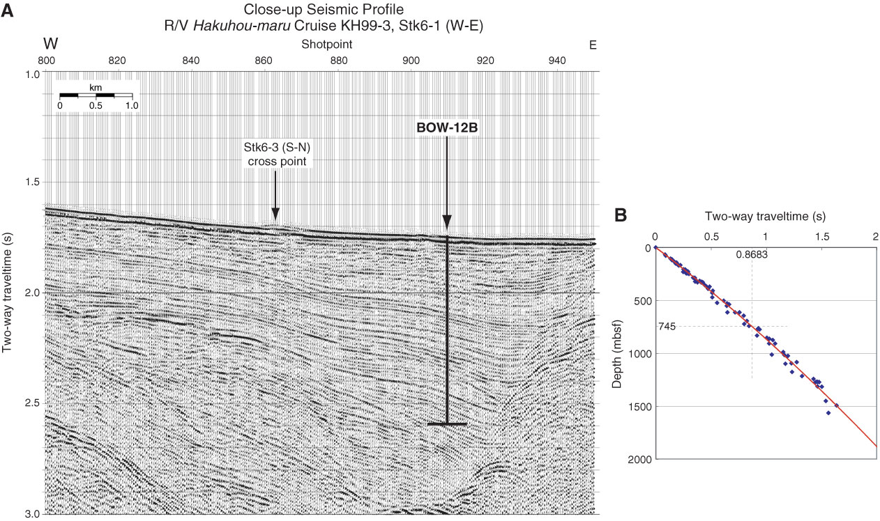
Figure AF5. A. Close-up seismic profile of Hakuhou-maru Cruise KH99-3 Line Stk6-1 (W–E) near Site BOW-12B (179°31.3´W, 53°24.0´N; Shotpoint 910; water depth = 1313 m; penetration depth = 700 m coring, 745 m if LWD is planned). Cross point with Line Stk6-3 (S–N) is at Shotpoint 863. B. Time-depth curve estimated from results of velocity analyses on Lines Stk6-1 and Stk6-3 around Site BOW-12B.
Previous | Close | Next | Top of page