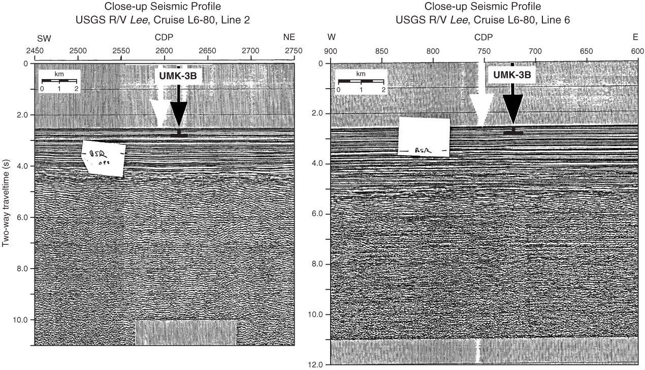
Figure AF59. A. Close-up seismic profile of USGS Lee Cruise L6-80 Line 2 with location of Site UMK-3B (170°14.6´W, 54°25.1´N; Shotpoint 2617; water depth = 1898 m) on cross point with Line 6. B. Close-up seismic profile of USGS Lee Cruise L6-80 Line 6 with location of Site UMK-3B (Shotpoint 721) on cross point with Line 2. Profiles are digitized from paper-form profiles at the SSDB. Stickied notation of the BSR was on the paper-form profile before digitization. CDP = common depth point.
Previous | Close | Next | Top of page