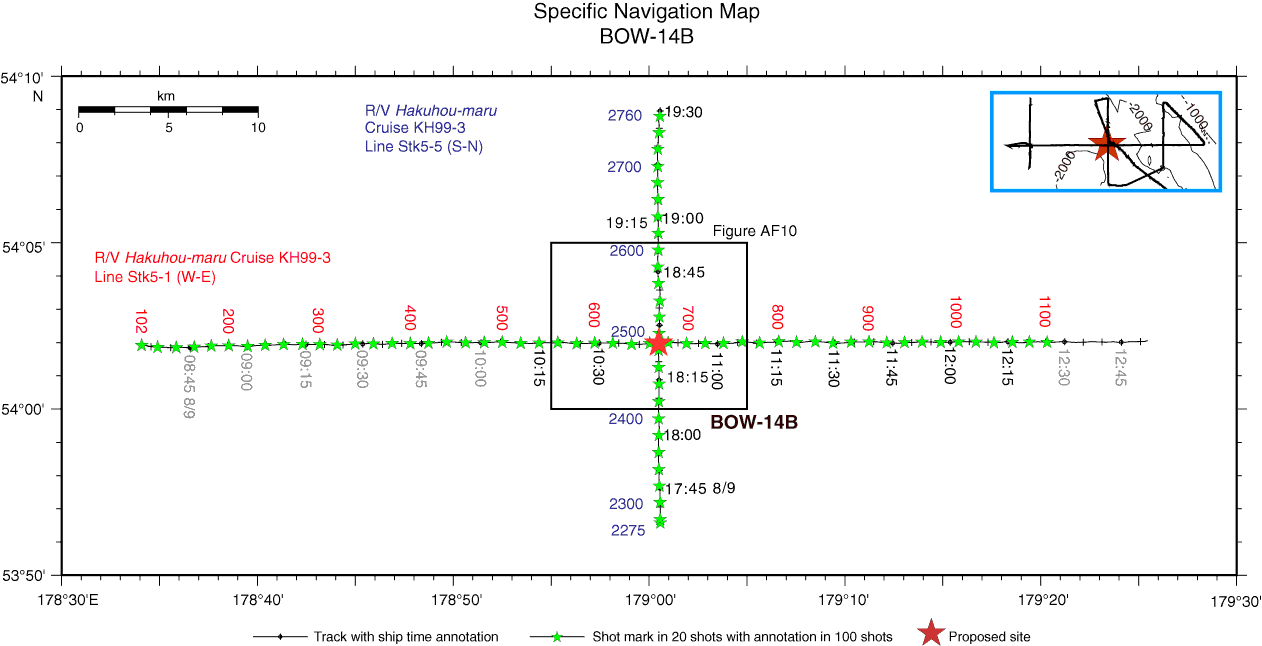
Figure AF9. Specific navigation map of Hakuhou-maru Cruise KH99-3 around Site BOW-14B with ship time and shotpoint annotation. Site is located at crossing of survey lines at 10:45:03, Shotpoint 670, on Line Stk5-1 (W–E) and 18:25:13, Shotpoint 2488, on Line Stk5-5 (S–N). Squares = navigation map area for close-up seismic profiles in Figure AF10. Time annotation in black letters = range of subbottom profile survey in Figure AF12.
Previous | Close | Next | Top of page