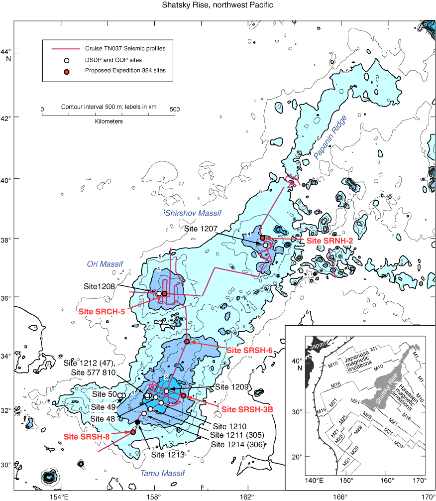
Figure F2. Location chart showing major features (blue shading), the Cruise TN037 site survey seismic tracks (purple lines), DSDP and ODP drill sites (open and solid circles), and proposed Expedition 324 primary drill sites (red circles). Light blue = elevations shallower than 5 km on Shatsky Rise. Black solid circle = Site 1213, where igneous rocks were cored during ODP Leg 198. Inset illustrates the location of Shatsky Rise (gray) in relation to western Pacific magnetic lineations (thin lines), trenches (toothed line), and Japan (black).
Previous | Close | Next | Top of page