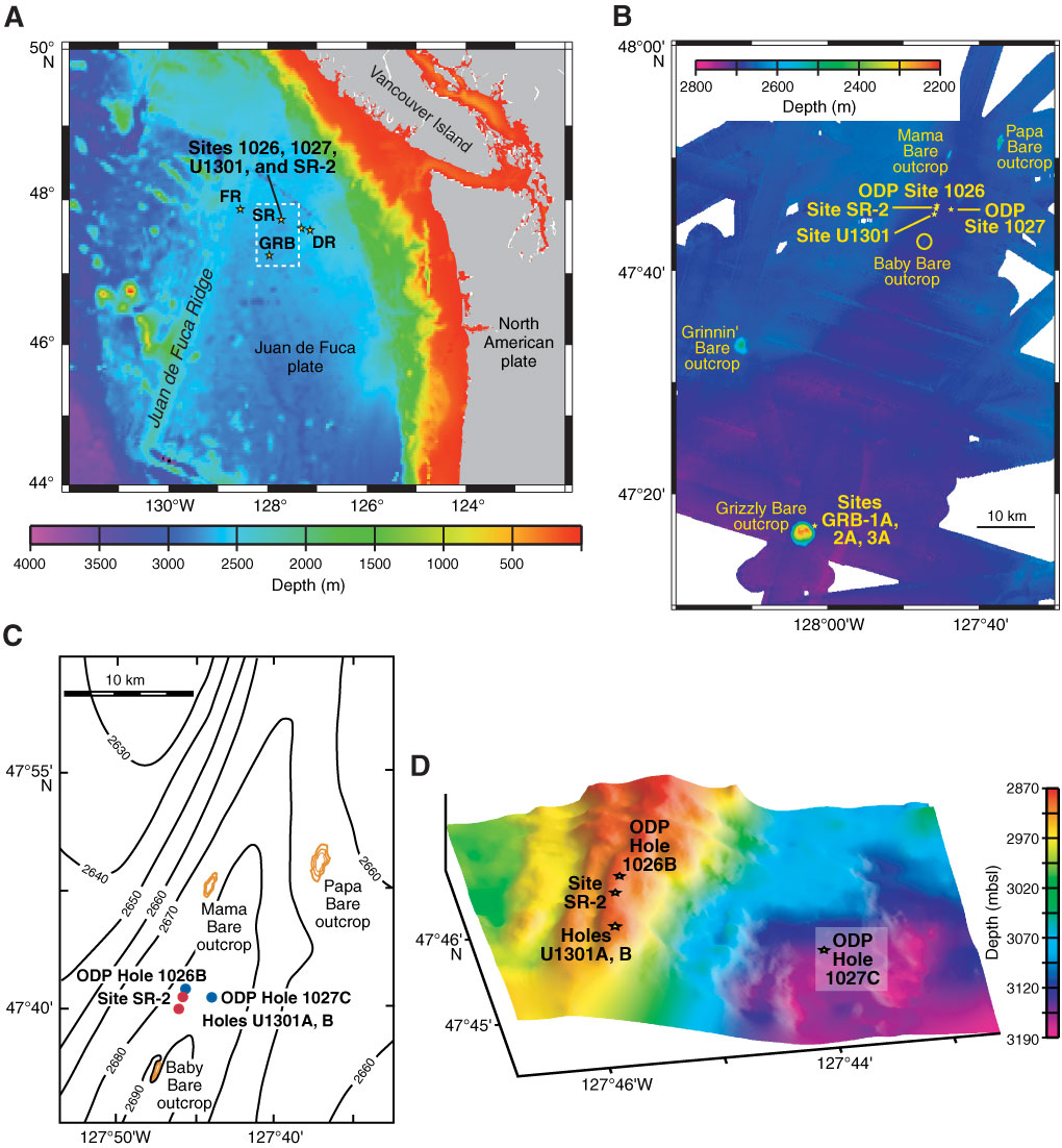
Figure F1. Site maps for Expedition 327 operations. A. Regional index map. SR = Second Ridge (primary site); GRB = Grizzly Bare, FR = First Ridge, DR = Deep Ridge (secondary sites). Area within white dashed box is shown in (B). B. Bathymetric map of SR and GRB areas. Locations of basement outcrops and ODP/IODP sites are also shown. C. Detailed bathymetric map of SR area, including local outcrops and ODP/IODP sites. D. Detailed basement relief map from bathymetric and seismic data made by "stripping off" the sediment cover above the volcanic crust. Holes 1026B, 1027C, U1301A, U1301B, and proposed Site SR-2 are shown.
Close | Next | Top of page