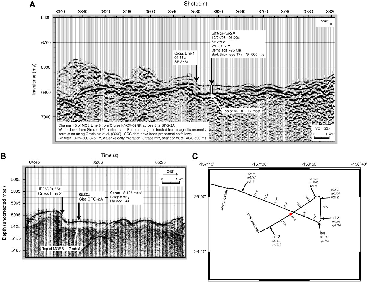
Figure AF5. A. Single-channel seismic (SCS) Line 3 from Cruise KNOX-02RR, proposed Site SPG-2A. MCS = multichannel seismic, BP = band-pass, TD = total depth, WD = water depth, SP = shotpoint, MORB = mid-ocean-ridge basalt, VE = vertical exaggeration. B. Portion of 3.5 Hz seismic Line 3. C. Survey track chart, proposed Site SPG-2A (seismic Lines 1–3). Start of line (sol) and end of line (eol) indicated with time (z) and shotpoint (sp). Tick marks are every 10 min (50 shots); selected tick marks labeled with shotpoint. Red dot = proposed Site SPG-2A.
Previous | Close | Next | Top of page