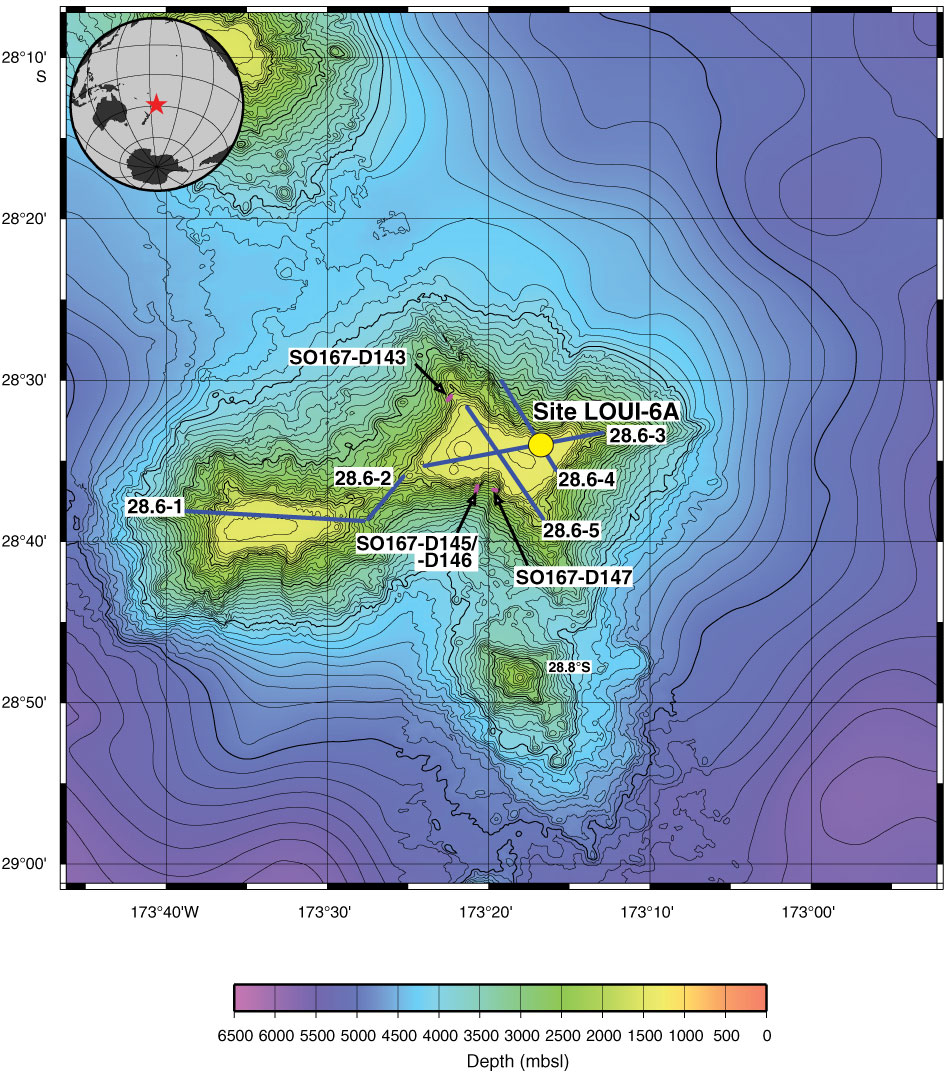
Figure AF13. Bathymetric map of the 28.6°S guyot along with the location of alternate Site LOUI-6A and seismic profiles (blue lines with track number). Pink lines indicate location of dredge hauls. Contour intervals = 100 m. Source of bathymetric map: earthref.org/SBN/.
Previous | Close | Next | Top of page