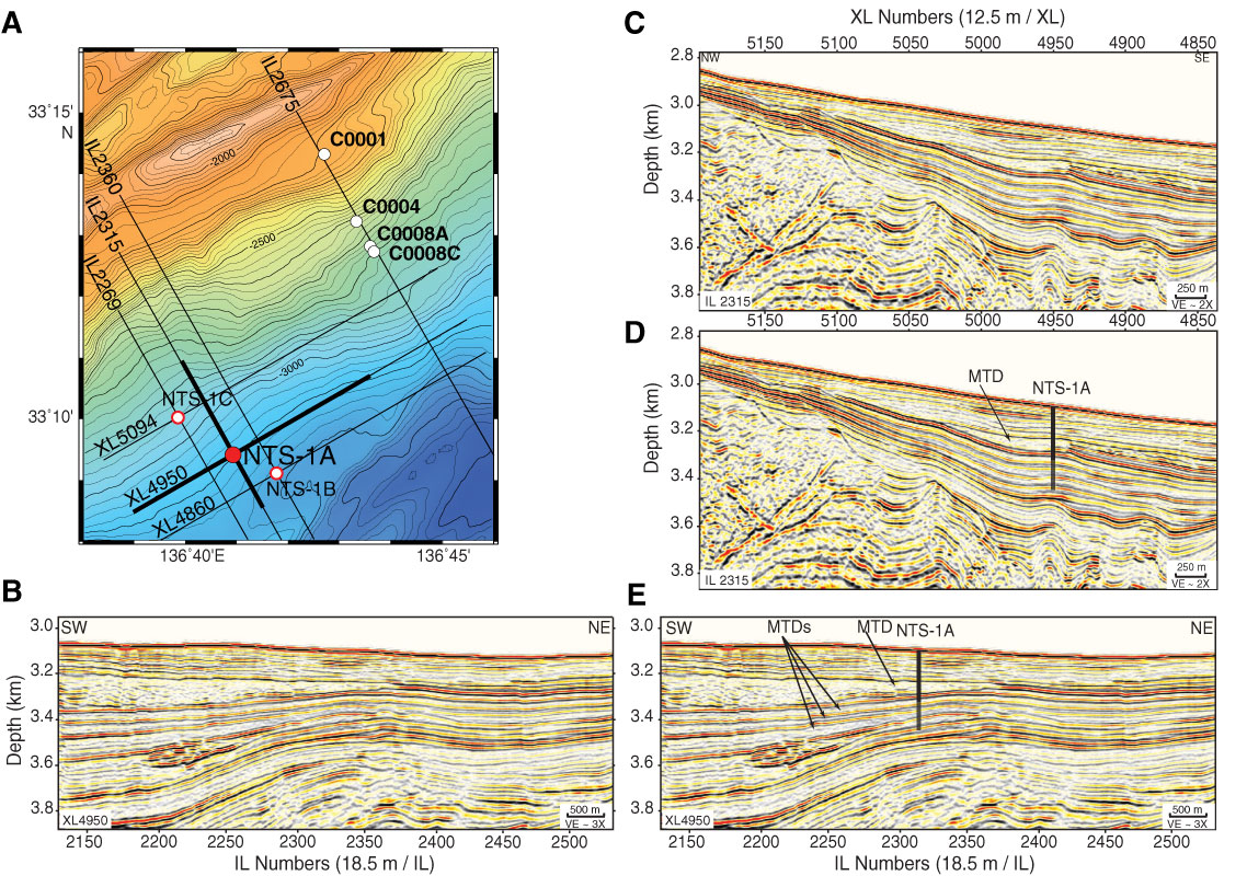
Figure F12. A. Colored bathymetry of the study area showing location of proposed drill Site NTS-1A and Sites C0001, C0004, and C0008. Bold black lines = location of 3-D seismic in-line (IL) and cross-line (XL) shown in (B) along strike oriented seismic profile and (C) dip-oriented seismic reflection profile. D, E. Seismic profiles with interpretation showing mass transport deposits (MTDs). Vertical gray and black lines = location of proposed Site NTS-1A and penetration depths to 350 mbsf (first priority target depth) and 225 mbsf (second priority target depth), respectively.
Previous | Close | Next | Top of page