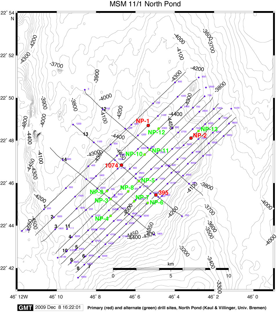
Figure AF1. Bathymetric map with southwest–northeast trending seismic Lines 1–11 and crossing Lines 12–14. Shot points are labeled in small blue fonts, and proposed drill sites are marked in red (primary sites) and green (secondary sites).
Close | Next | Top of page