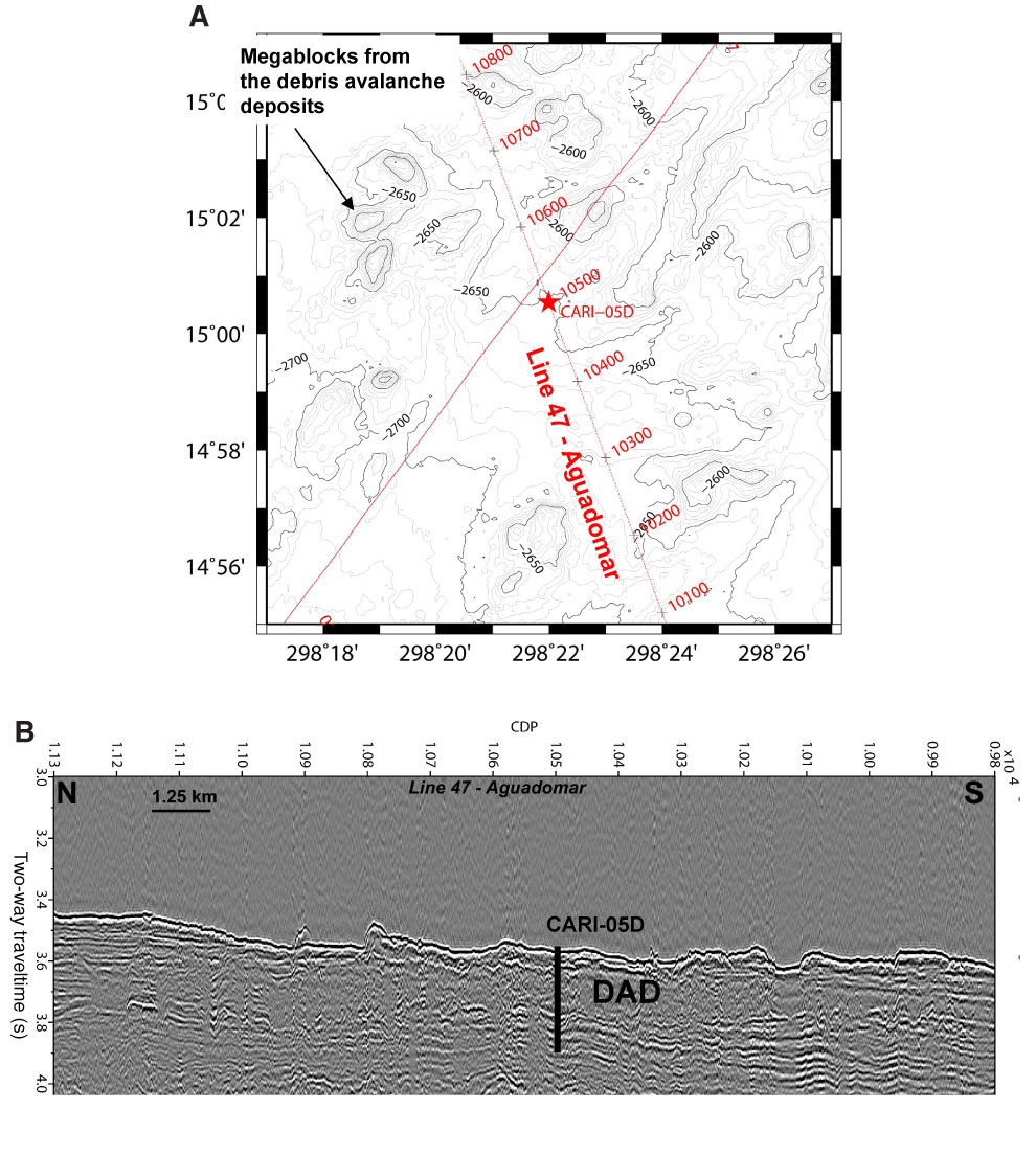
Figure AF5. (A) Track map (50 m resolution, 10 m contour interval) and (B) seismic line (penetration 357 m) for proposed primary Site CARI-05D. Data obtained from the Aguadomar cruise in 1999. CDP = common depth point, DAD = debris avalanche deposit.

Previous | Close | Next | Top of page