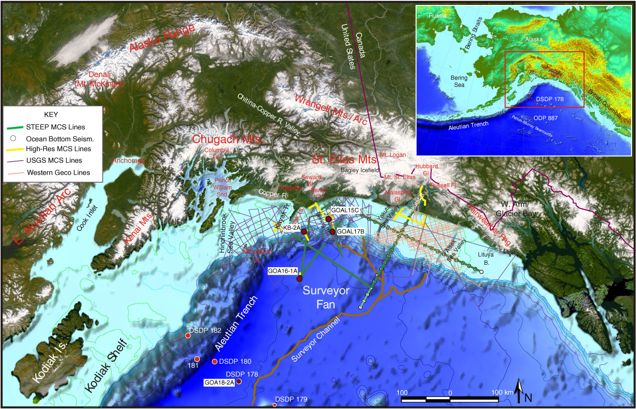
Figure F2. The Gulf of Alaska (GoA) region: geography and location of previous DSDP and ODP drilling locations (see inset) and the proposed drilling sites (GOAL/KB locations). There is significant regional coverage of seismic reflection data on the shelf. High-resolution multichannel seismic (MCS) lines collected in 2004 are shown in yellow. Reflection and refraction lines (green) were collected in summer 2008 as part of the STEEP program.
Previous | Close | Next | Top of page