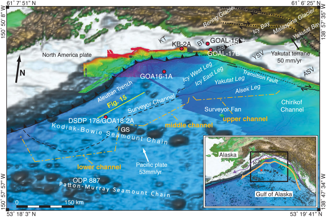
Figure F7. 3-D perspective view of the bathymetry/topography of the southern Alaska continental margin, showing tectonic boundaries, and the Surveyor Fan in high-resolution bathymetry. ASV = Alsek Sea Valley, BT = Bering Trough, GS = Giacomini Seamount, KT = Kayak Trough, PS = Pamplona Spur, YSV = Yakutat Sea Valley. Data sources: plate boundaries adapted from Gulick et al. (2007); high-resolution bathymetry (Gardner et al., 2006); remaining bathymetry (Smith and Sandwell, 1997); Yakutat terrane motion relative to North America (Elliott et al., 2010); Pacific plate motion (Kreemer et al., 2003). Inset: Location of Alaska Coastal Current (ACC; purple); Alaska Current (AC; orange); and NOAA wave buoy 4600 (red star). Modified from Reece et al., in press.
Previous | Close | Next | Top of page