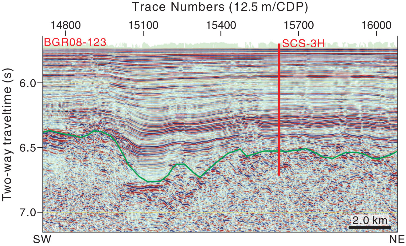
Figure AF19. Seismic profile Line BGR08-123 (southwest–northeast) with location of proposed Site SCS-3H (14°28.368′N, 116°50.082′E; common depth point [CDP] 15625; water depth = 4304 m; target depth = 866 mbsf). Green line = interpreted top basement.
Previous | Close | Next | Top of page