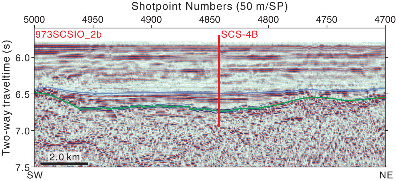
Figure AF25. Seismic profile Line 973SCSIO_2b (southwest–northeast) with location of proposed Site SCS-4B (12°55.137′N, 115°2.8326′E; shotpoint [SP] 4847; water depth = 4380 m; target depth = 965 mbsf). Green line = interpreted top basement; blue line = age uncertain.
Previous | Close | Next | Top of page