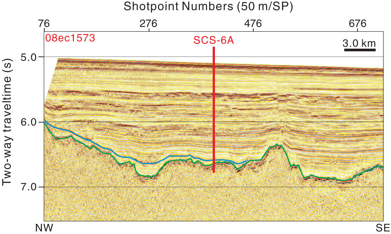
Figure AF3. Seismic profile Line 08ec1573 (northwest–southeast) with location of primary Site SCS-6A (18°21.117′N, 116°23.45′E; shotpoint [SP] 400; water depth = 3843 m; target depth = 1930 mbsf). Green line = interpreted top basement, blue line = interpreted top Oligocene.
Previous | Close | Next | Top of page