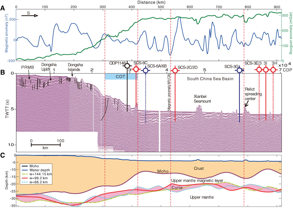
Figure F7. Proposed sampling transect in the East Sub-basin (after Li et al., 2010). A. Total field magnetic anomaly (blue) and Bouguer anomaly (green) along the seismic line shown in B. B. Proposed drill sites in the East Sub-basin and ODP Site 1148 shown on a composite seismic line. Solid lines = sites that fall on the seismic profile. Dashed lines = site locations projected onto the line. C. Depths to the Moho and Curie point estimated from gravity and magnetic anomalies, respectively. TWTT = two-way traveltime; COT = continent–ocean transition zone; PRMB = Pearl River Mouth Basin; w = width of moving windows.
Previous | Close | Next | Top of page