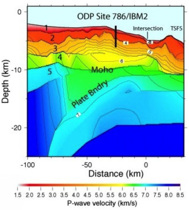
Figure F8. P-wave velocity structure obtained by nonlinear inversion along the east–west line of Kamimura et al. (2002), ~150 km north of proposed Sites BON-1A and BON-2A and an equivalent distance south of ODP Site 786 (Fig. F1). BON-1A and BON-2A lie between Site 786 and the point marked “Intersection” if projected onto this section. The colors indicate seismic velocities in km/s and the numerals indicate seismic layers (1 = sediments, 2 = lavas and dikes, 3–4 = gabbroic, 5 = peridotite). Lavas + sheeted dikes at the longitude of Sites BON-1A and BON-2A are as thick as 2 km; hence, we expect to drill a maximum of 1.5 km of lavas to reach sheeted dikes. IBM = Izu-Bonin-Mariana, TSFS = Torishima fore-arc seamount.
Previous | Close | Next | Top of page