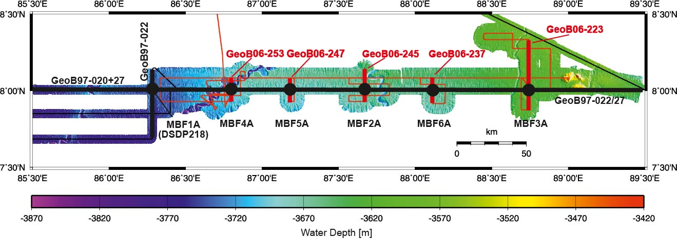
Figure F4. Map showing Expedition 354 drill sites on top of multibeam bathymetry. Available seismic lines from R/V Sonne Cruises SO125 (black) and SO188 (red) are indicated. Profiles crossing the sites are highlighted. See “Site summaries” and appendix figures for seismic data at each proposed site.
Previous | Close | Next | Top of page