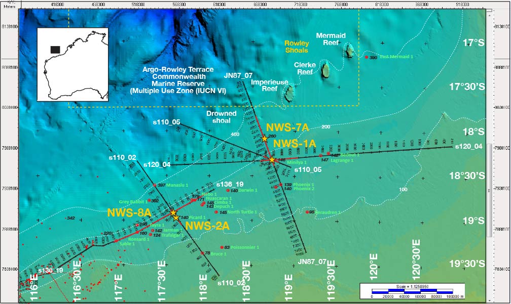
Figure AF11. Bathymetric map showing the seafloor around primary Sites NWS-1A and NWS-2A and alternate Sites NWS-7A and NWS-8A. Bathymetric data are derived from the Geoscience Australia Australian bathymetry and topography grid, June 2009. The positions of multichannel seismic profiles are shown. The Rowley Shoals are a series of three atolls close to the seismic profiles.
Previous | Close | Next | Top of page