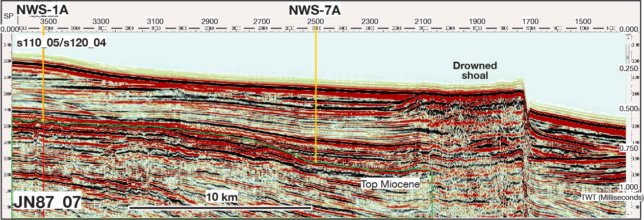
Figure AF15. Multichannel seismic profile across primary Site NWS-1A and alternate Site NWS-7A. The drowned shoal indicated is a fourth Rowley Shoal atoll that subsided from the sea surface to ~300 meters below sea level during the Pleistocene. Green line denotes the inferred top of the Miocene. TWT = two-way traveltime.
Previous | Close | Top of page