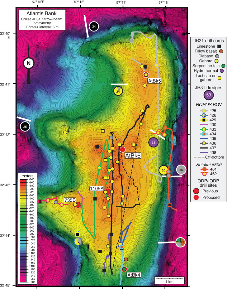
Figure F3. High-resolution contoured narrow-beam bathymetry map of Atlantis Bank wave-cut platform, showing remotely operated vehicle (ROV) and submersible dive tracks plus locations of shallow and deep drill cores. Primary proposed drill site is AtBk6; contingency Sites AtBk4 and AtBk5 are also marked.
Previous | Close | Next | Top of page