Next Section | Table of Contents
doi:10.2204/iodp.pr.308.2005
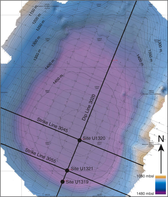
Figure F5. Bathymetric chart of Brazos-Trinity Basin #4 showing locations for dip seismic Line 3020 and the three sites drilled during Expedition 308. Depth contours are at 10 m intervals. Artificial sun illumination from the northwest. Bathymetric information adapted from report Number 3060-TAMU-GOM.