Next Section | Table of Contents
doi:10.2204/iodp.pr.311.2005
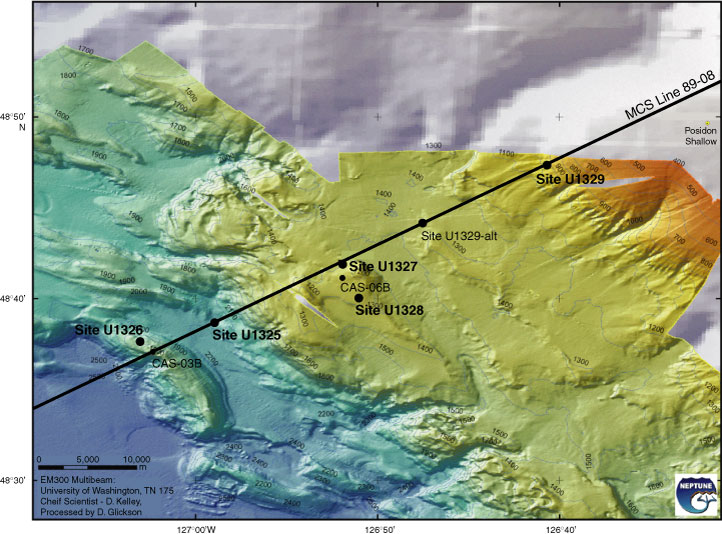
Figure F4. Multibeam bathymetry map along the transect across the accretionary prism offshore Vancouver Island (courtesy of D. Kelley, J. Delaney, and D. Glickson, University of Washington, and C. Barnes, C. Katnick, NEPTUNE Canada, University of Victoria; funded by the University of Washington and the W.M. Keck Foundation). MCS = multichannel seismic.