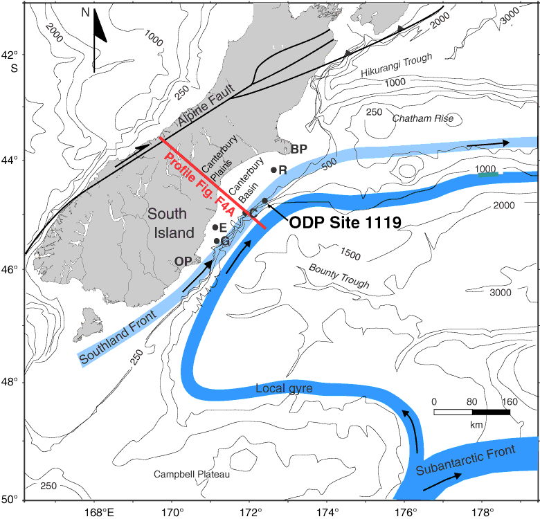
Figure F2. The Canterbury Basin underlies the present-day onshore Canterbury Plains and offshore continental shelf. It is bounded by the Miocene volcanic centers of the Banks Peninsula (BP) (5.8–12 Ma) (Watters, 1978) to the northeast and the Otago Peninsula (OP) (9.6–16.0 Ma) (Coombs et al., 1986; Hoernle et al., 2006) to the southwest and faces the Bounty Trough to the southeast. The Alpine Fault is the boundary between the Australasian and Pacific plates. Locations of the modern Southland Front and Subantarctic Front, together with local gyre within the Bounty Trough, are shown (Chiswell, 1996; Shipboard Scientific Party, 1999a; Morris et al., 2001). Also shown are the four exploration wells in the offshore basin (Resolution [R], Clipper [C], Endeavour [E], and Galleon [G]) as well as ODP Site 1119. A fifth well, Cutter, was drilled in 2006; information concerning Cutter-1, however, is sparse. Bathymetric contours are in meters.
Previous | Close | Next | Top of page