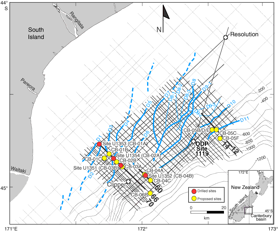
Figure F3. Drilled and alternate sites, together with EW00-01 high-resolution (frequencies as high as 300 Hz) multichannel seismic (MCS) grid (thick straight lines), low-resolution CB-82 commercial MCS grid (thin straight lines), exploration wells Clipper and Resolution, and ODP Site 1119. The EW00-01 survey was designed to provide improved vertical resolution (~5 m in the upper 1 s) to enhance our definition of high-frequency sedimentary sequences. Also shown is the distribution of seismically resolvable sediment drifts D1–D11 (blue curved lines = drift mound crests). Drifts D1–D6 and D10–D11 are simple elongate drifts, and D7–D9 are complex drifts. Drift D8 has three subcrests (D8-1, D8-2, and D8-3) and is a multicrested complex drift. Drift D9 is a multistage drift with superimposed subdrifts D9-1, D9-2, and D9-3. Dashed blue lines = drifts identified on CB-82 profiles. Thick black lines = locations of dip profiles shown in Figures F7, F8, and F9 (66, 12, and 60, respectively). Other dip profiles containing alternate sites are also labeled (12, 14, and 70). Bathymetric contours are in meters.
Previous | Close | Next | Top of page