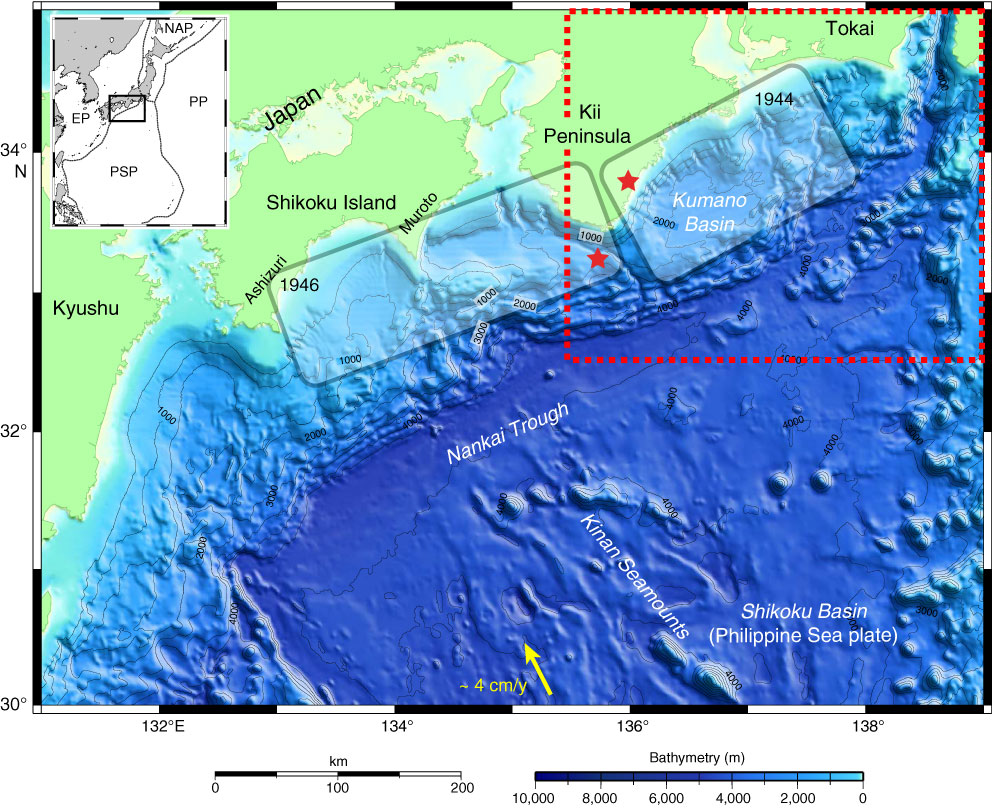
Figure F1. Bathymetric map, Nankai Trough off southwestern Japan is the locus of subduction of the Philippine Sea plate (PSP) beneath Honshu and Shikoku islands. Arrow = convergence direction between PSP and Japan. Rupture zones of the last two large subduction earthquakes (1944 and 1946) are also shown. Stars = epicenter locations for earthquake nucleation. Red dashed line = Expedition 322 drilling area shown in Figure F2. Inset shows location of Nankai Trough. Previous transects of Nankai Trough were positioned off Ashizuri and Muroto peninsulas of Shikoku. EP = Eurasian plate, PP = Pacific plate, NAP = North American plate.
Close | Next | Top of page