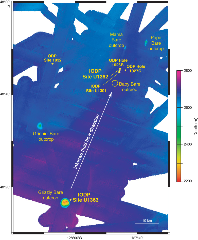
Figure F2. Regional bathymetric map showing locations of Expedition 327 drill sites and basement outcrops (modified from Zühlsdorff et al., 2005). Thermal and chemical data suggest that hydrothermal fluids recharge at Grizzly Bare outcrop and flow to the north–northwest (white arrow).

Previous | Close | Next | Top of page