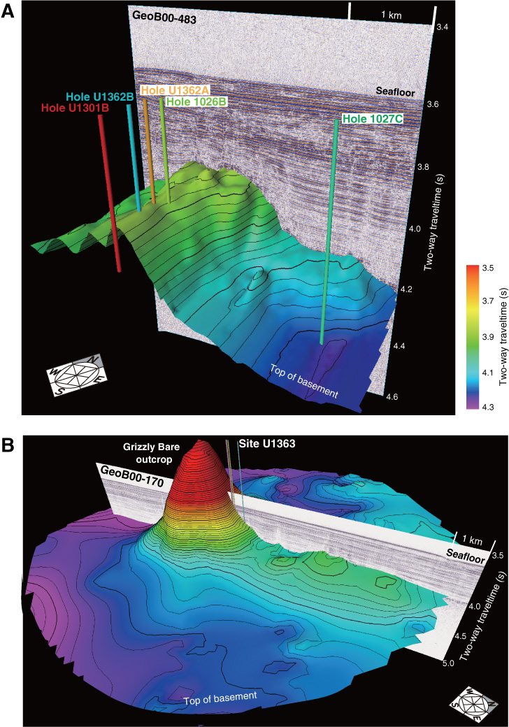
Figure F3. Three-dimensional perspective views of basement relief around Expedition 327 drill sites. Bathymetry based on digitization of seismic lines across work areas (data from Rosenberger et al., 2000; Zühlsdorff et al., 2005; Hutnak et al., 2006). Relief is shown as two-way traveltime, with no conversion to sediment thickness or depth. A. Basement relief around Sites 1026, 1027, U1301, and U1362, contoured to maintain continuity along-strike ~N20E to highlight steeply dipping normal faults to west of drill sites. B. Basement relief around Site U1363, adjacent to Grizzly Bare outcrop.
Previous | Close | Next | Top of page