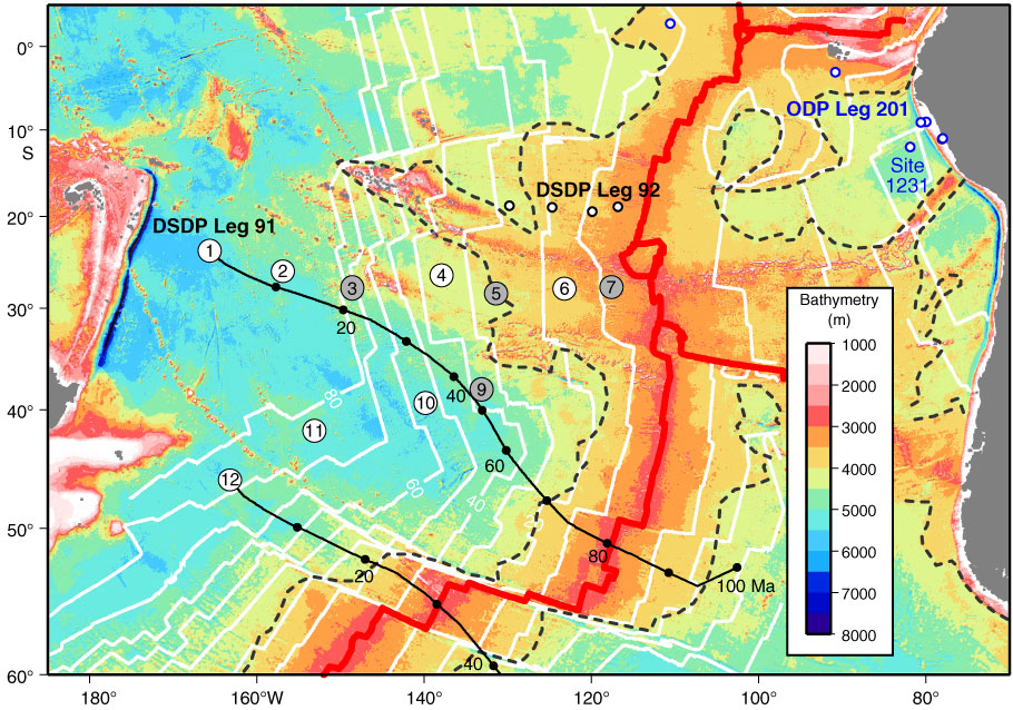
Figure F2. South Pacific seafloor bathymetry map (Smith and Sandwell, 1997) illustrating tectonic setting and location of sites drilled during Expedition 329 (circled numbers; corresponds to proposed site number). White circles = nearest DSDP drill sites; blue circles = nearest ODP drill sites.

Previous | Close | Next | Top of page