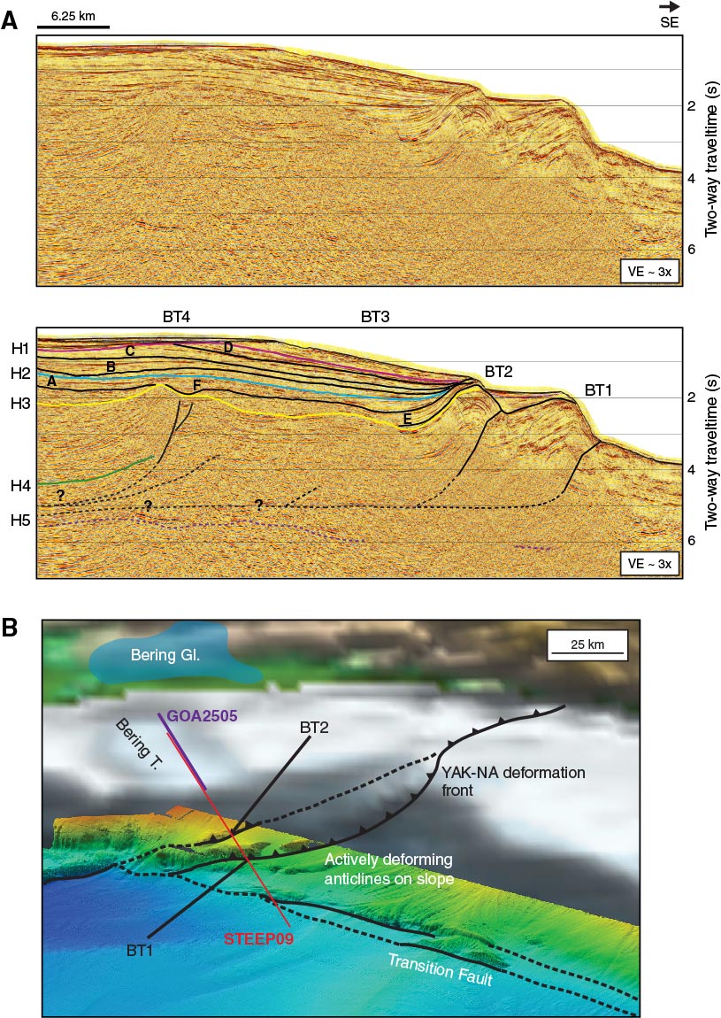
Figure F10. A. STEEP09 seismic line, uninterpreted (top) and interpreted (bottom), showing mappable horizons through the Bering Glacier shelf region. Targets for Site U1420 include H1, an angular unconformity at the base of glacial erosion surfaces, and H2, which marks the cessation of movement on the Pamplona zone structures beneath the Bering Trough. B. Perspective view of the Bering Trough region showing locations of the trough relative to active structures of the Pamplona zone. YAK-NA = Yakutat Terrane beneath North America. Modified from Worthington et al. (2010).
Previous | Close | Next | Top of page