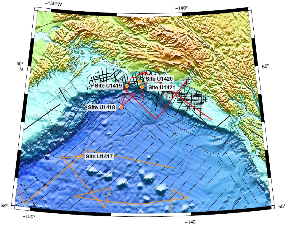
Figure F8. Seismic reflection data for the Gulf of Alaska (GoA) region relative to the drilling sites. Black lines = USGS or Industry acquired seismic profiles, red lines = 2008 R/V Langseth seismic profiles from the NSF ST, Elias Erosion and tectonics Project (STEEP) and orange lines = 2011 Langseth Extended Continental Shelf seismic profiles, orange dots = Expedition 341 drill sites.
Previous | Close | Next | Top of page