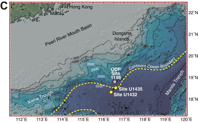
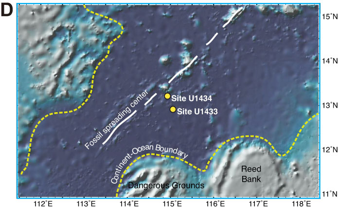
Figure F8 (continued). C. Detailed bathymetry around Sites U1432 and U1435 (red box in A) showing nearby continental shelf, the Manila Trench, and inferred continent/ocean boundary. D. Detailed bathymetry around Sites U1433 and U1434 (blue box in A) showing nearby seamount and Dangerous Grounds and Reed Bank to the south.
Previous | Close | Next | Top of page