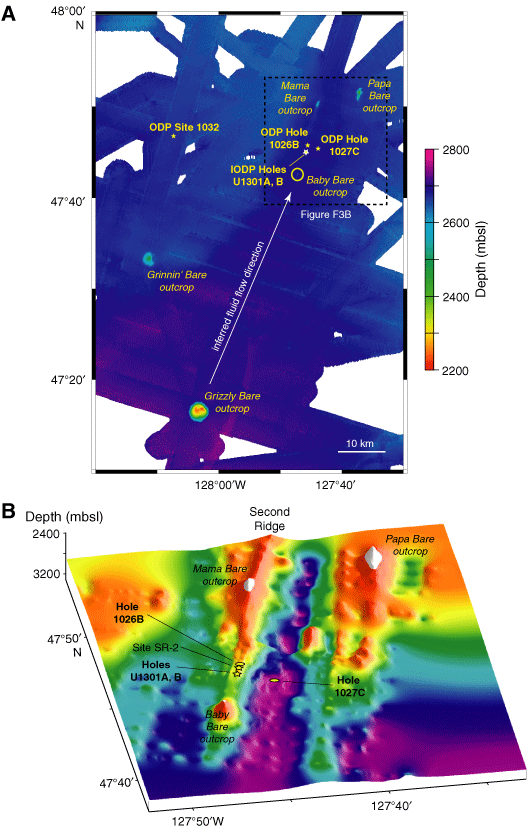
Figure F3. Second Ridge maps. A. Topographic map showing Second Ridge and surrounding region (modified from Fisher et al., 2003). Locations of ODP and IODP holes are shown, as are locations of outcrops that penetrate regionally continuous sediment cover. B. Basement map of Second Ridge drilling area, showing ODP and IODP hole locations (Zühlsdorff et al., this volume). Data are based on bathymetry shown in A and interpretation of ~25 seismic lines collected during the 2000 Sonne expedition (ImageFlux). Holes at Site SR-2 will be drilled during a subsequent expedition.