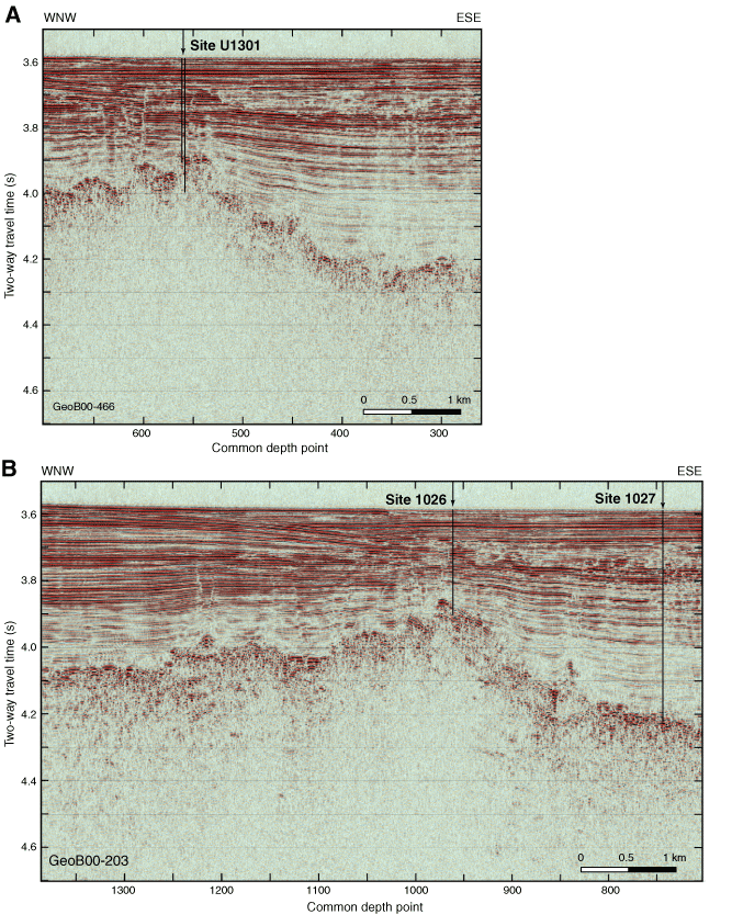
Figure F4. Examples of MCS seismic data from the 2000 ImageFlux survey (Sonne, SO149) showing locations of primary Expedition 301 sites. A. Line GeoB00-446 across the southern part of Site U1301. Vertical lines indicate approximate total depth of Holes U1301A (shallower) and U1301B (deeper). B. Line GeoB00-203 across Sites 1026 and 1027. Vertical lines indicate approximate total depth of both holes. Characteristic basement and sedimentary structures are apparent in both lines. These features are described in the text and in Zühlsdorff et al. (this volume), who also discuss data acquisition and processing.