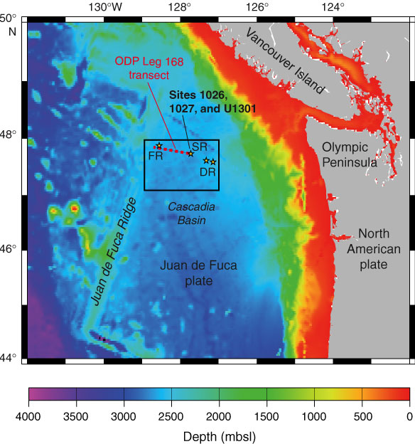
Figure F1. Regional bathymetric map showing locations of IODP Expedition 301 sites, the ODP Leg 168 drilling transect, and selected regional tectonic features. Bathymetry from Smith and Sandwell (1997). SR = Second Ridge (primary work area during Expedition 301). DR = Deep Ridge, FR = First Ridge (secondary [backup] work areas for Expedition 301). Box shows location of Figure F2.