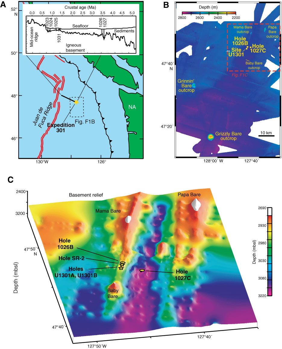
Figure F1. Expedition 301 field area. A. Index map of ODP Leg 168 drilling transect (thick black line), Expedition 301 work area (gold star), Juan de Fuca Ridge, and nearby continental areas. Inset profile of Leg 168 sites mentioned in the text. B. Regional bathymetric map of Holes 1026B and 1027C and Site U1301. C. Basement relief from bathymetric and seismic data with ODP and IODP drill sites. White areas = present-day basement outcrops. Figure modified from Zühlsdorff et al.
Close | Next | Top of page