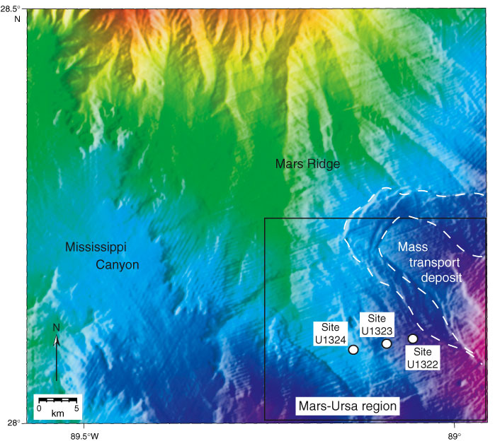
Figure F2. Striking bathymetry in the Mars-Ursa region is produced by the thick wedge of Pleistocene sediments from the Mississippi River. Mars Ridge is the bathymetric expression of a buried Pleistocene channel-levee system. Location of map is shown in Figure F1. Box locates Figure F3.
Previous | Close | Next | Top of page