Previous | Close | Next
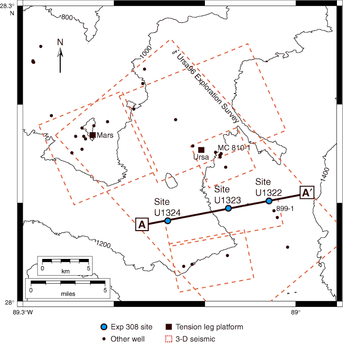
Figure F3. Base map of the Mars-Ursa study area with location of seismic data, well locations, and bathymetry contours. Contour interval = 200 m. Figure is located in Figure F1.
Previous | Close | Next | Top of page