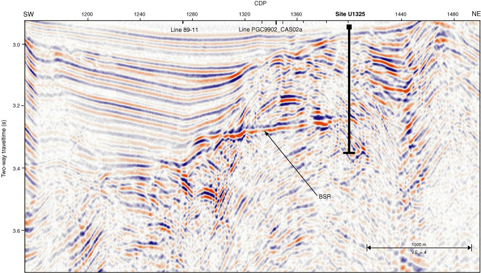
Figure F2. Section of multichannel seismic Line 89-08 over Site U1325. The data are of low seismic frequency content from 10 to 50 Hz. A buried ridge of accreted sediments can be identified between common depth points (CDPs) 1320 and 1440, covered by a thin interval of slope basin–type sediments that onlap onto the ridge. A bright spot is identified underneath the center of the ridge, potentially indicating the presence of free gas. A strong bottom-simulating reflector (BSR) is seen over much of the eastern section of the basin, whereas it disappears underneath the western part of the basin, which is filled with as much as 600 ms two-way traveltime (TWT) thick slope basin–type sediments. Site U1325 intersects an interval of 300 ms TWT thickness where sediments show a strong eastward dip. V.E. = vertical exaggeration.
Previous | Close | Next | Top of page