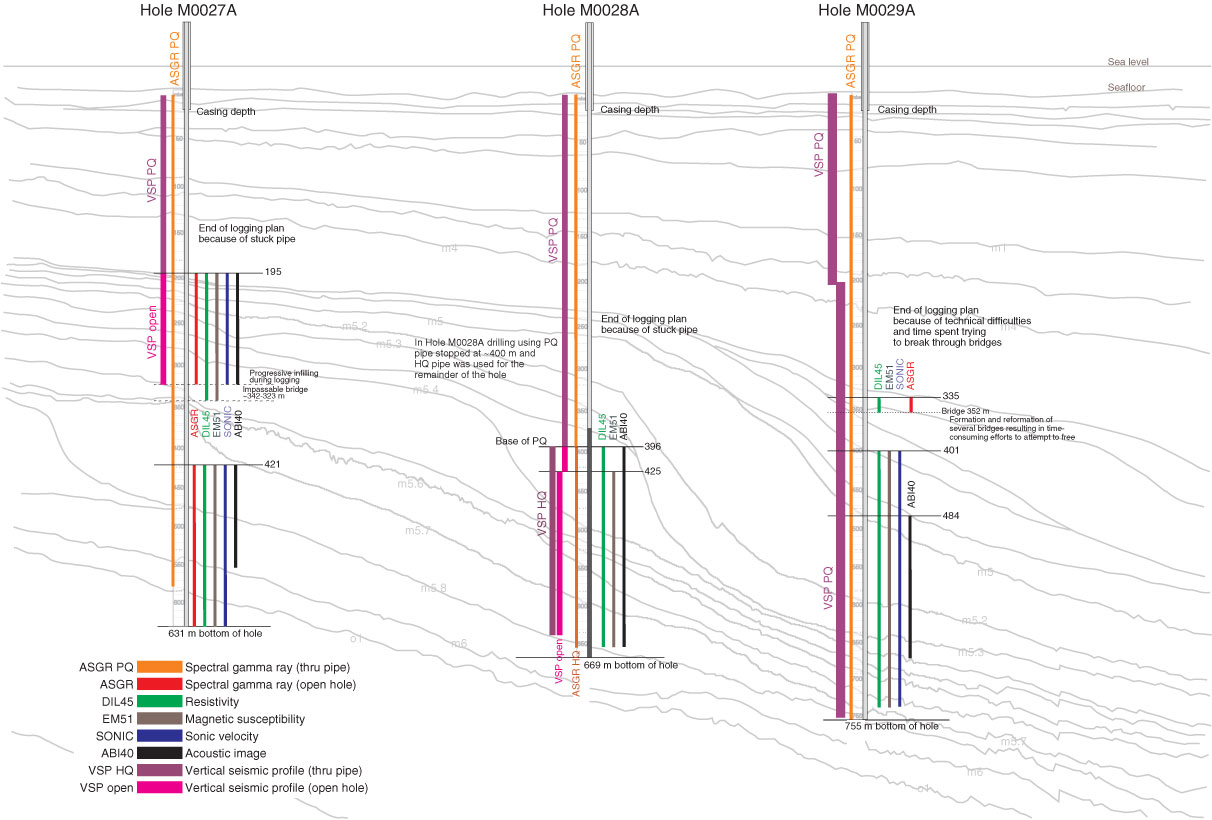
Figure F15. Graphic summary of downhole measurements collected offshore during Expedition 313. Open-hole logging was planned and carried out in stages beginning with the lower section of each borehole. Sediments in the upper ~200 m of each hole were generally unstable. Deterioration of these shallow portions during the early stages of logging the deepest intervals may have contributed to difficulty pulling pipe. Gray reflectors were traced from Oc270 MCS line 529 (see Fig. F16); two-way traveltimes have been converted to depths below seafloor and are shown to the left of each drill site. Vertical seismic profile (VSP) and through-pipe gamma logs are displayed to the left of the actual position of each borehole. Open-hole logs are shown to the right. Colored vertical bars show approximate positions of logs.
Previous | Close | Next | Top of page