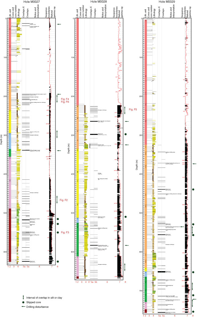
Figure F1. Overview of all identified overlaps across Holes M0027A, M0028A, and M0029A. For a more detailed scale, refer to OverlapsSummary_detail.ai in OVERLAP in “Supplementary material.” Core depths are in meters below seafloor (CSF-A), and downhole logging depths are in meters wireline depth below seafloor (WSF; see IODP Depth Scales Terminology at http://www.iodp.org/top-resources/program-documents/policies-and-guidelines). Column numbers (red): 1 = depth, 2 = lithostratigraphic (sedimentological) units, 3 = core boundaries (every tenth core run marked), 4 = lithology, 5a = identified overlap intervals (black bars) from measured depths on the Multisensor Core Logger, 5b = identified intervals overlap shaded, excluding the core catcher, 6 = relevant notes taken during drilling operations accompanied by interpretations of how the core depths are most accurately corrected in the overlap intervals with sequence boundaries on the right, 7 = downhole (red) and recovered core (black) natural gamma radiation (NGR) measurements, 8 = annotations for types of overlap discussed in the text. See the “Methods” chapter (Expedition 313 Scientists, 2010a) for lithostratigraphic unit, lithology pattern, and sequence boundary definitions. This figure is available in an oversized format.
Close | Next | Top of page