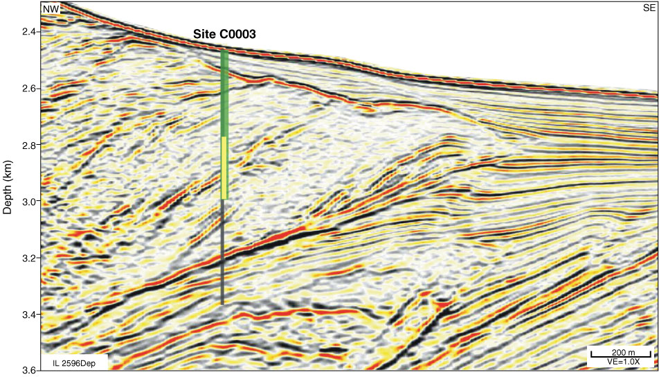
Figure F7. Inline 2596, Site C0003. Black line = originally planned total depth of 1000 mbsf, green line = actual depth achieved when the drill string became stuck, yellow line = approximate length of stuck bottom-hole assembly equipment. The reflector that intersects the borehole at ~2.9 km depth is interpreted as a fault zone and is the probable source of dated cavings of late Miocene age in the hole. VE = vertical exaggeration.

Previous | Close | Next | Top of page