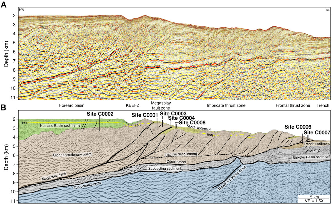
Figure F6. Composite seismic line extracted from 3-D seismic volume. The line crosses through (or near) all Stage 1 drill sites (location shown in Figs. F2 and F4). A. Uninterpreted version. B. Interpreted version. Only a few representative faults are shown. Dashed lines = less certain fault locations. Morphotectonic zones are shown between the two sections. KBEFZ = Kumano Basin edge fault zone, PTZ = protothrust zone. BSR = bottom-simulating reflector. VE = vertical exaggeration.

Previous | Close | Next | Top of page