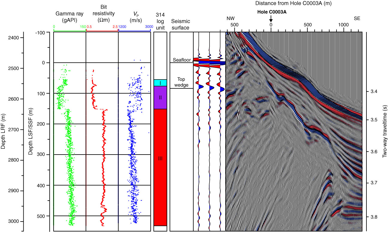
Figure F27. Seismic data correlated to well data, Site C0003. Logging data displayed represent real-time (MWD) data because LWD tool was lost during drilling (see Expedition 314 Scientists, 2009a). Expedition 314 logging units derived from Expedition 314 Scientists (2009b) also displayed. Top wedge is surface mapped on seismic data that represents top of thrust wedge. Seismic data displayed are time-based (scale on right).
Previous | Close | Next | Top of page