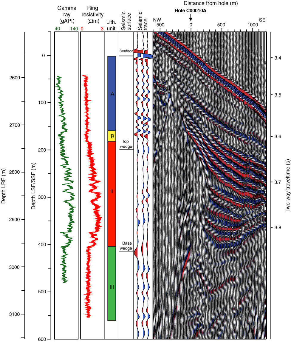
Figure F28. Seismic data correlated to well data, Site C0010. Top wedge and base wedge are surfaces mapped on seismic data that represent top and bottom of thrust wedge. Seismic data displayed are time-based (scale on right).

Previous | Close | Next | Top of page