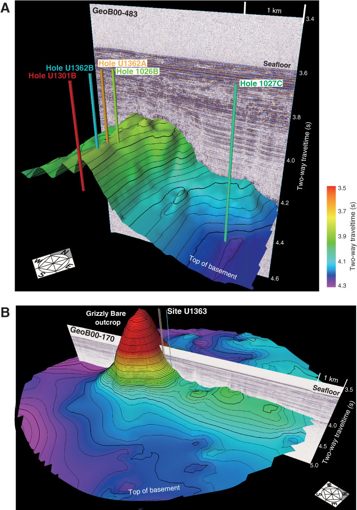
Figure F3. Three-dimensional perspective views of basement relief around Expedition 327 drill sites. Bathymetry based on digitization of seismic lines across work areas (data from Rosenberger et al., 2000; Zühlsdorff et al., 2005; Hutnak et al., 2006). Relief is shown as two-way traveltime, with no conversion to sediment thickness or depth. A. Basement relief around Sites 1026, 1027, U1301, and U1362, contoured to maintain continuity along-strike (~N20E) to highlight steeply dipping normal faults to west of drill sites. B. Basement relief around Site U1363, adjacent to Grizzly Bare outcrop. Detailed hole locations at Site U1363 are shown in “Operations” and “Background and objectives” in the “Site U1363” chapter.
Previous | Close | Next | Top of page