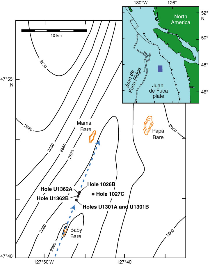
Figure F1. Bathymetric map illustrating locations of borehole observatories for cross-hole tracer experiment. Inset shows regional setting, with area of main figure shown by blue rectangle. Contour interval = 10 m, gold contours = basement outcrops. Tracer injection during Expedition 327 occurred in Hole U1362B. Monitoring for tracer arrival is occurring with automated samplers integrated with CORK observatories in Holes U1301A, U1301B, U1362A, and 1026B and in Hole U1362B, where tracers were injected. Blue dashed arrows = general direction of inferred fluid flow in basement, based on geochemical, geothermal, and numerical modeling studies (e.g., Wheat et al., 2000; Fisher et al., 2003; Hutnak et al., 2006; Walker et al., 2007). Hole 1027C was intended to be configured as an additional monitoring point for the tracer experiment, but Expedition 327 was not able to recover and replace the old observatory (see the “Site 1027” chapter). An attempt will be made to retrofit the old observatory for pressure monitoring and fluid sampling during a summer 2011 CORK servicing expedition.
Close | Next | Top of page