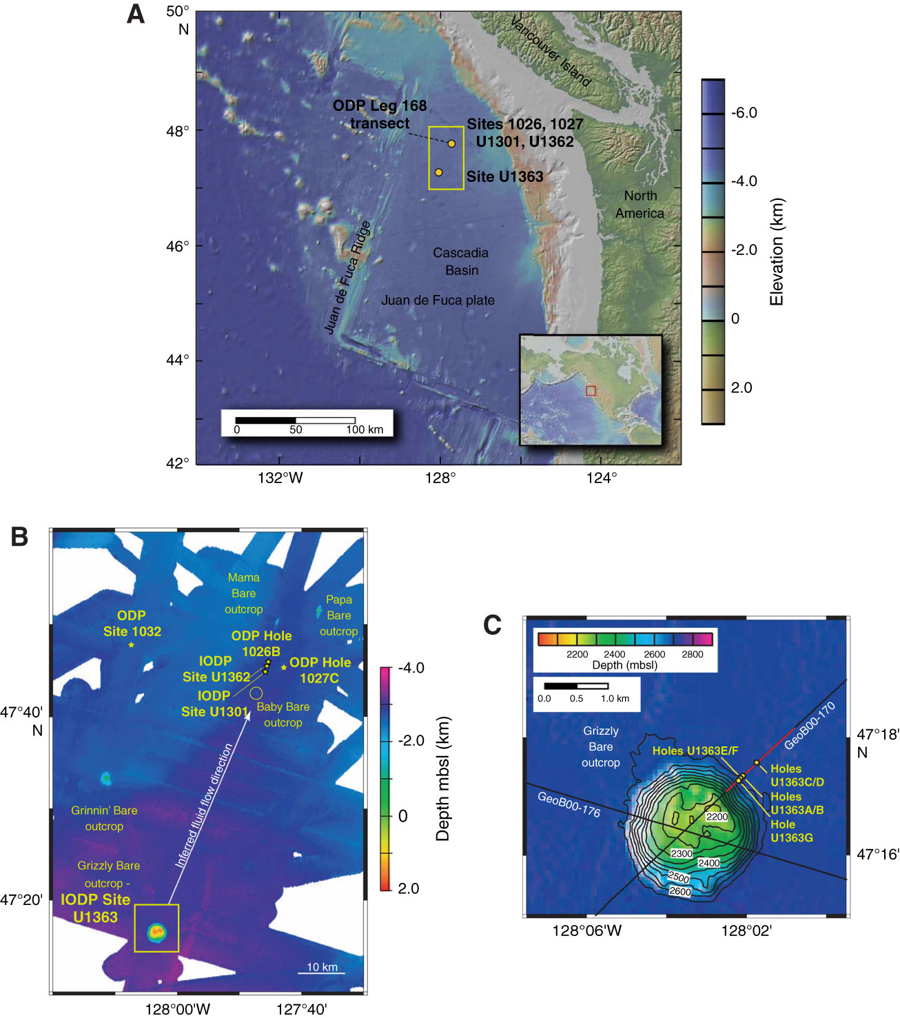
Figure F1. A. Site locations, Integrated Ocean Drilling Program (IODP) Expedition 327. Site U1363 is adjacent to a large basement outcrop ~52 km south-southwest of the dashed line that denotes Ocean Drilling Program (ODP) Leg 168 (Shipboard Scientific Party, 1997). The yellow box indicates the location of B (modified from Expedition 327 Scientists, 2011a). B. Regional bathymetry of Expedition 327 and previous expedition sites and basement outcrops. Thermal and chemical data suggest hydrothermal fluids recharge at Grizzly Bare outcrop and flow north-northeast (white arrow). The yellow box indicates the location of C (modified from Expedition 327 Scientists, 2011a). C. Bathymetry around Grizzly Bare outcrop and Site U1363. Black lines indicate tracks of reflection seismic lines around Hole U1363B collected during the 2000 ImageFlux expedition (Zühlsdorff et al., 2005; Hutnak et al., 2006). Part of Line GeoB00-170 (red line) is shown in Figure F2A (modified from Expedition 327 Scientists, 2011c).
Close | Next | Top of page